Local governments are receiving support from the B.C. government for emergency evacuation planning.
The Ministry of Emergency Management and Climate Readiness announced Wednesday, Aug. 9, that the Adams Lake Band, the Columbia Shuswap Regional District (CSRD) and the Thompson Nicola Regional District (TNRD) were among 19 government bodies that would receive funding to develop and updating evacuation plans and local emergency-alerting systems.
“Recent wildfires in remote regions of B.C. have put communities at risk of being cut off from the rest of the province, highlighting the need for good, advanced planning to ensure residents are able to evacuate safely,” said Emergency Management and Climate Readiness minister Bowinn Ma. “We also know that First Nations and local governments have the most up-to-date information to provide to people to keep them safe. These funds will help ensure British Columbians can leave the area safely when a disaster hits, and will improve emergency notification, alerts and communication to people during emergencies.”
Read more: New wildfire sparked near Mabel Lake in North Okanagan
Read more: Fire guard being constructed for Shuswap communities south of Adams Lake blaze
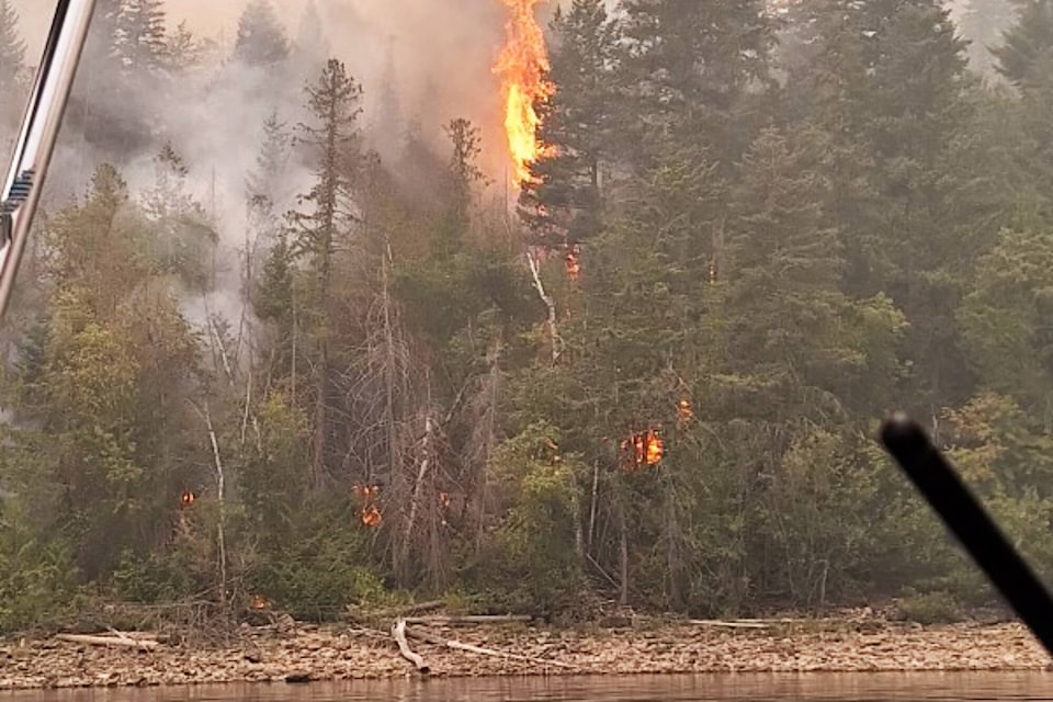
From the $880,000 being distributed from the province’s Community Emergency Preparedness Fund, $30,000 was going to the Adams Lake Band for an emergency route review and governance policy development; $29,500 to the CSRD for community evacuation route planning and its Alertable awareness project; and $27,625 to the TNRD for an evacuation route review. All three government organizations currently have evacuation orders and/or alerts in effect due to wildfires at Adams Lake, including the 1,789-hectare Bush Creek East blaze on lake’s west side and, to the east, the 4,823-hectare Lower East Adams Lake wildfire.
On Monday, Aug. 7, Electoral Area F (North Shuswap) director Jay Simpson said the CSRD was preparing evacuation plans for Lee Creek and Scotch Creek, just in case the worst should happen.
“We’ve been told a number of times that BC Wildfire is very aware of the communities of Lee Creek and Scotch Creek, they know the population… they know our exit routes,” said Simpson. “Squilax-Anglemont Road is not the only one although it’s by far the best, so that’s going to be their goal, to make sure that road is protected to the fullest extent possible.”
Over the weekend the BC Wildfire Service was building a fire guard to assist in protecting North Shuswap communities to the south of the Lower East Adams fire, including Lee Creek.
lachlan@saobserver.net
Like us on Facebook and follow us on Twitter
Sign up for our newsletter to get Salmon Arm stories in your inbox every morning.
